Isla Mona
Puerto Rico's Galapagos
About Isla Mona
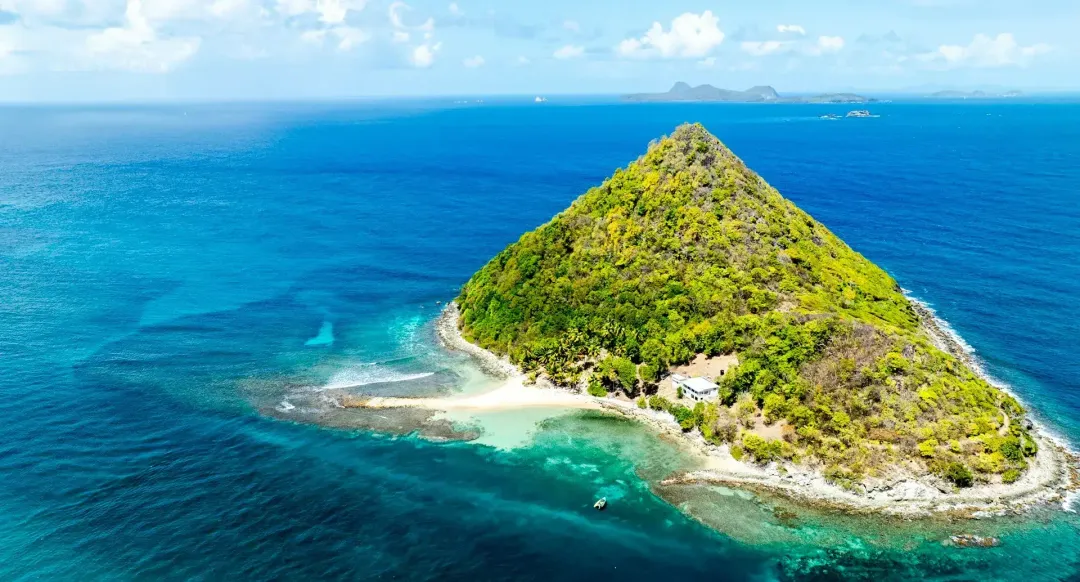
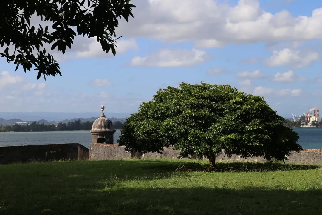
Isla Mona is an uninhabited island located in the Mona Passage between Puerto Rico and the Dominican Republic, often referred to as the 'Galapagos of the Caribbean' due to its ecological significance and isolation. This 22-square-mile limestone plateau rises dramatically from the sea with sheer cliffs reaching heights of up to 200 feet, creating a striking landscape visible from miles away. The island, along with nearby Monito Island, is designated as the Mona and Monito Natural Reserve, managed by Puerto Rico's Department of Natural Resources, with access strictly limited to maintain its pristine condition. Isla Mona's unique ecosystem supports endemic species found nowhere else, including the Mona ground iguana, which can grow up to four feet long. The island's interior features a karst landscape with extensive cave systems containing pre-Columbian Taíno petroglyphs and evidence of guano mining operations from the 19th century. The coastline offers some of the Caribbean's most pristine beaches, particularly at Playa Sardinera and Playa Pájaros, with crystal-clear waters ideal for snorkeling and diving among vibrant coral reefs, where visibility often exceeds 150 feet. As an uninhabited nature reserve, Isla Mona has no permanent residents, hotels, restaurants, or infrastructure beyond basic camping facilities and a ranger station. Visitors must obtain permits from Puerto Rico's Department of Natural Resources, typically arriving by chartered boat from western Puerto Rico for camping trips lasting several days. The island's remoteness and limited facilities make it suitable only for adventurous travelers comfortable with rustic conditions, including bringing all necessary supplies and adhering to strict conservation rules. This isolation has preserved Isla Mona as one of the Caribbean's last true wilderness areas, offering an experience of nature largely unchanged since pre-Columbian times.
Size
22 sq mi (57 km²)
Population
0 (uninhabited, only rangers and researchers)
Language
Spanish (rangers and visitors)
Currency
US Dollar (USD)
Time Zone
UTC-4 (Atlantic Time)
Best Time to Visit
December to May

Highlights
Best Things to Do in Isla Mona
Isla Mona is not a casual day trip - it is a multi-day wilderness expedition that requires serious planning and a tolerance for discomfort. But for those who make the crossing, the reward is one of the last truly wild places in the Caribbean. The journey begins with a permit application to Puerto Rico's Departamento de Recursos Naturales y Ambientales (DRNA), which can take weeks to process and limits visitors to small groups. Most chartered boats depart from Joyuda or Boqueron on Puerto Rico's west coast, and the crossing of the Mona Passage takes three to five hours depending on seas - this stretch of water is notoriously rough, so seasickness medication is not optional.
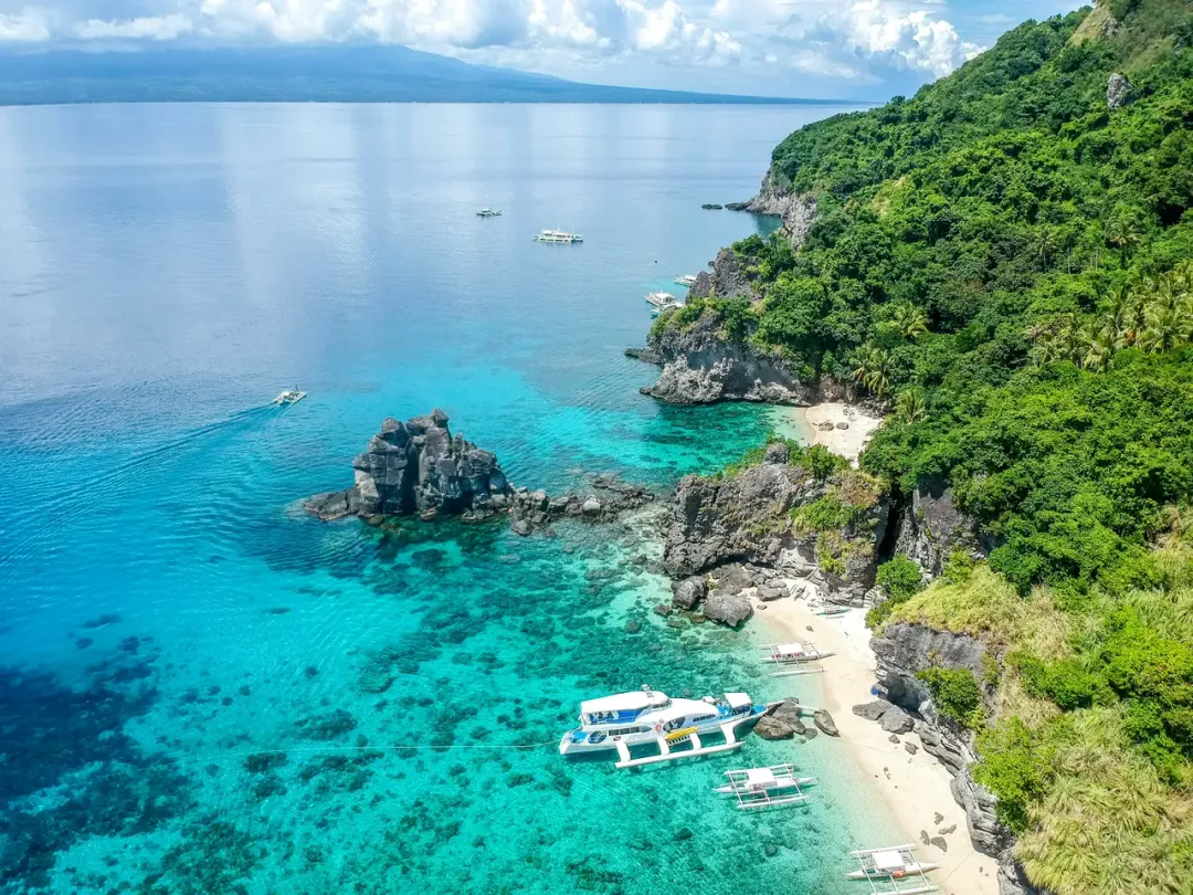
Once ashore at Playa Sardinera, the island's main landing beach on the western coast, you set up camp at the designated camping area near the ranger station. From here, the island unfolds on foot. The coastal cliffs on the southern and eastern sides rise up to 200 feet straight from the sea, creating a dramatic limestone wall riddled with caves.
The cave systems are Isla Mona's hidden treasure - over 200 mapped caves contain Taino petroglyphs, stalactite formations, and evidence of 19th-century guano mining operations. Cueva del Lirio and Cueva Negra are among the most impressive, with pre-Columbian drawings etched into the walls. Above ground, the flat plateau interior is covered in dry forest and cactus scrub, home to the Mona ground iguana, a hefty endemic reptile that can reach four feet in length and shows little fear of humans.
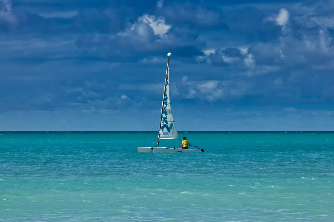
The snorkeling directly off Playa Sardinera and Playa Pajaros is extraordinary - the isolation means the reefs are in pristine condition, with visibility regularly exceeding 40 meters and encounters with hawksbill turtles, nurse sharks, and eagle rays. Divers who arrange tanks (brought from the mainland) can explore wall dives along the southern cliffs where the drop-off is sheer and the coral growth undisturbed. The old lighthouse, Faro de Isla de Mona, sits on the southeastern plateau and is worth the hot hike for the views alone.
Explore the Cave Systems
Over 200 caves perforate Isla Mona's limestone plateau. The most significant contain Taino petroglyphs and pictographs dating back centuries. Rangers can guide you to accessible caves near the camping area. Bring a reliable headlamp and closed-toe shoes - the cave floors are uneven and sharp.
Snorkel at Playa Sardinera
The main landing beach offers some of the Caribbean's clearest water, with visibility exceeding 40 meters on calm days. The reef starts just offshore, with elkhorn coral, brain coral, and dense schools of tropical fish. Bring all your own gear - nothing is available on the island.
Observe the Mona Ground Iguana
This endemic species, Cyclura stejnegeri, is found only on Isla Mona. Adults can exceed four feet in length and are remarkably unbothered by human presence. You will spot them throughout the plateau interior and near the camping area, especially in the early morning when they bask in the sun.
Hike to Faro de Isla de Mona
The lighthouse on the southeastern plateau was built in the 1900s and offers sweeping views of the cliffs and open ocean. The hike from camp is about three miles each way across exposed terrain with no shade - start at dawn and carry at least two liters of water per person.
Dive the Southern Wall
The southern cliff face continues underwater as a dramatic wall dive dropping well past 30 meters. Black coral, sponge gardens, and large pelagics are common. You must bring all dive equipment and tanks from the mainland, and conditions require advanced certification due to currents.
Camp Under the Stars
With zero light pollution, Isla Mona offers some of the best stargazing in the Caribbean. The Milky Way is clearly visible on moonless nights. Camping is at the designated area near Playa Sardinera, with basic pit toilets but no other facilities.
Where to Stay in Isla Mona
There are no hotels, guesthouses, or any permanent accommodation on Isla Mona. Camping at the designated area near Playa Sardinera is the only option, and it is as bare-bones as Caribbean travel gets. The campsite has pit toilets and a basic shelter structure, but no running water, no electricity, and no provisions of any kind. You must bring everything: tent, sleeping gear, cooking equipment, food, and - critically - all your drinking water for the entire stay.
Plan on a minimum of one gallon per person per day, more if you are hiking in the heat. Most visitors camp for two to four nights, which is enough to explore the caves, snorkel the reefs, and hike to the lighthouse. The rangers are friendly and helpful but cannot supply visitors with anything.
Before and after the crossing, most travelers stay in Cabo Rojo or Boqueron on Puerto Rico's southwest coast, where hotels and guesthouses range from $70 to $150 per night. Combate Beach Hotel and Boqueron Beach Hotel are both serviceable options near the boat launch points. Budget travelers use Airbnb rentals in Cabo Rojo, which start around $50.
Where to Eat in Isla Mona
There is no food on Isla Mona - no restaurants, no vendors, no stores, nothing. You must bring every calorie with you from the mainland. Plan meals carefully: lightweight, non-perishable foods that do not require refrigeration are essential. Canned goods, dried pasta, rice, trail mix, energy bars, and jerky are staples.
If your boat captain is a fisherman (many are), you may be able to grill fresh catch on the beach, which is one of the great pleasures of a Mona trip - bring a portable grill grate and charcoal. All waste must be packed out; the island is a strict nature reserve.
Before departure, stock up in Cabo Rojo or Boqueron, where supermarkets carry everything you need. For your pre-trip and post-trip meals, Boqueron has excellent seafood at casual waterfront spots. Annie's Place on the Boqueron boardwalk serves outstanding mofongo and fried snapper. El Bohío in Cabo Rojo is a local favorite for criollo cooking - roast pork, rice with pigeon peas, and alcapurrias.
Bring a celebratory bottle of rum for your last night on the island; you will have earned it.
Best Time to Visit Isla Mona
December through May offers the driest weather and calmest seas for the Mona Passage crossing, which is the single biggest variable in planning a trip. The passage is one of the roughest stretches of water in the Caribbean, with strong currents and unpredictable swells - winter months generally provide the best window, though conditions can deteriorate quickly any time of year.
Confirm sea conditions with your charter captain in the days before departure and be prepared to postpone. Summer brings higher temperatures on the shadeless plateau (regularly above 90 degrees Fahrenheit), more rain, and the onset of hurricane season.
September and October are the highest-risk months for storms and the worst time to attempt the trip. Water visibility for snorkeling and diving peaks from January through April.
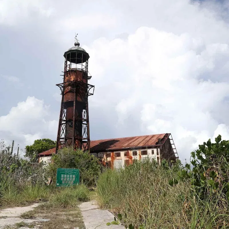
Mona Island Lighthouse
Mona Island Lighthouse is a historical site on Isla Mona. This historic site reflects the rich cultural heritage and storied past of Isla Mona. It offers a glimpse into the events and traditions that have shaped the island over centuries.

Punto más al Oeste de PR
Punto más al Oeste de PR is a nature attraction on Isla Mona. This natural area showcases the lush tropical landscapes and diverse ecosystems that Isla Mona is known for. Visitors can explore the local flora and fauna in a serene setting.
Hotels in Isla Mona
Search for available rates by selecting your travel dates
No hotels found near Isla Mona.
Top Restaurants in Isla Mona
Popular dining spots near Isla Mona
No restaurants available for Isla Mona yet.
Weather in Isla Mona
Average Temperature
75°F to 85°F (24°C to 29°C)
Rainy Season
August to November
Hurricane Season
June to November
Best Time to Visit
December to May
Travel Tips
- Spanish is the primary language, though rangers may speak some English
- Permits are required from Puerto Rico's Department of Natural Resources
- No permanent facilities or services are available on the island
- Visitors must bring all necessary supplies, including water
- The island is only accessible by chartered boat or private vessel
- Camping is the only accommodation option
Get Isla Mona Travel Tips
Subscribe for curated tips, deals, and inspiration for your Isla Mona trip.